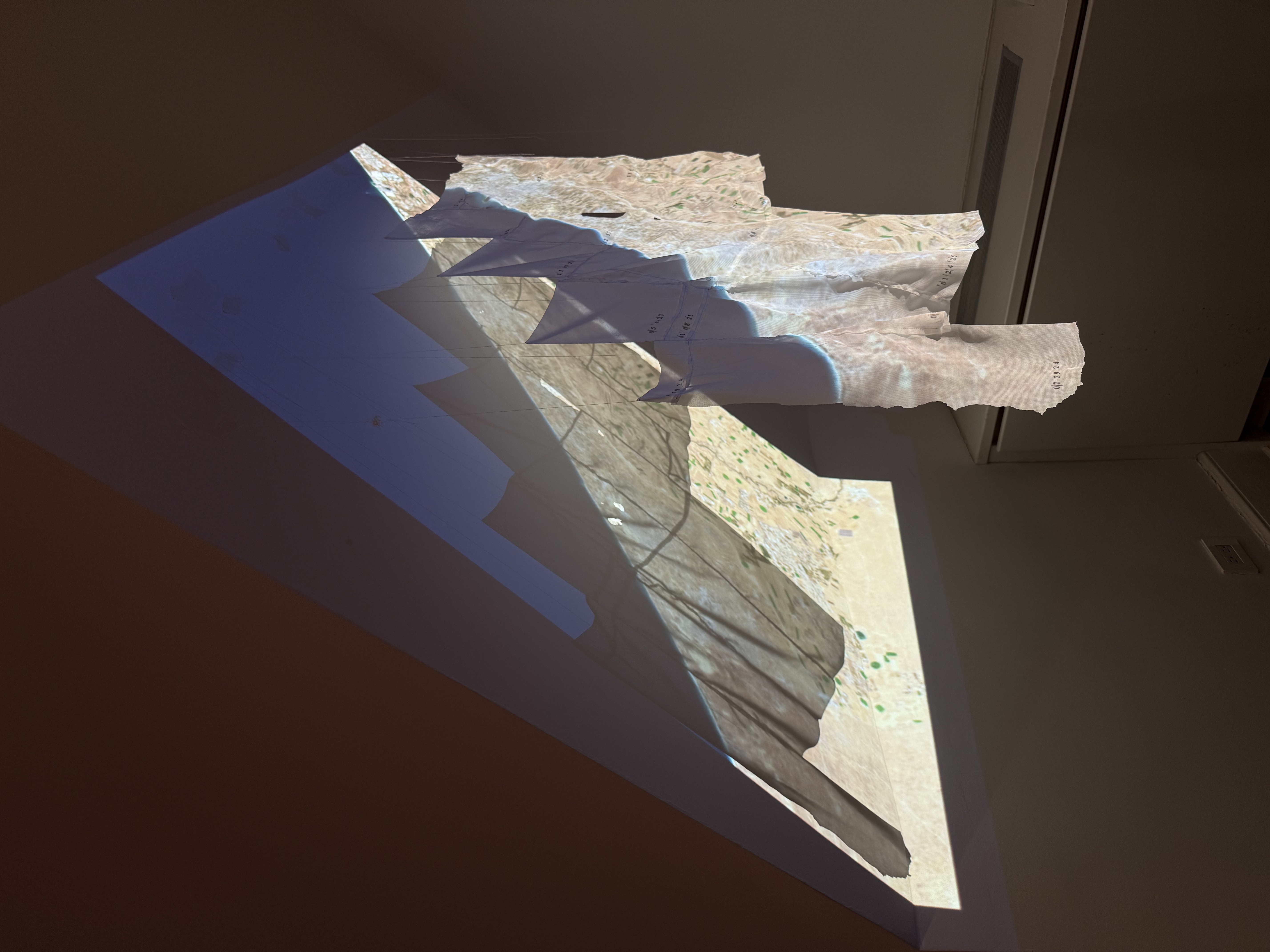
Projecting Topographies (II)
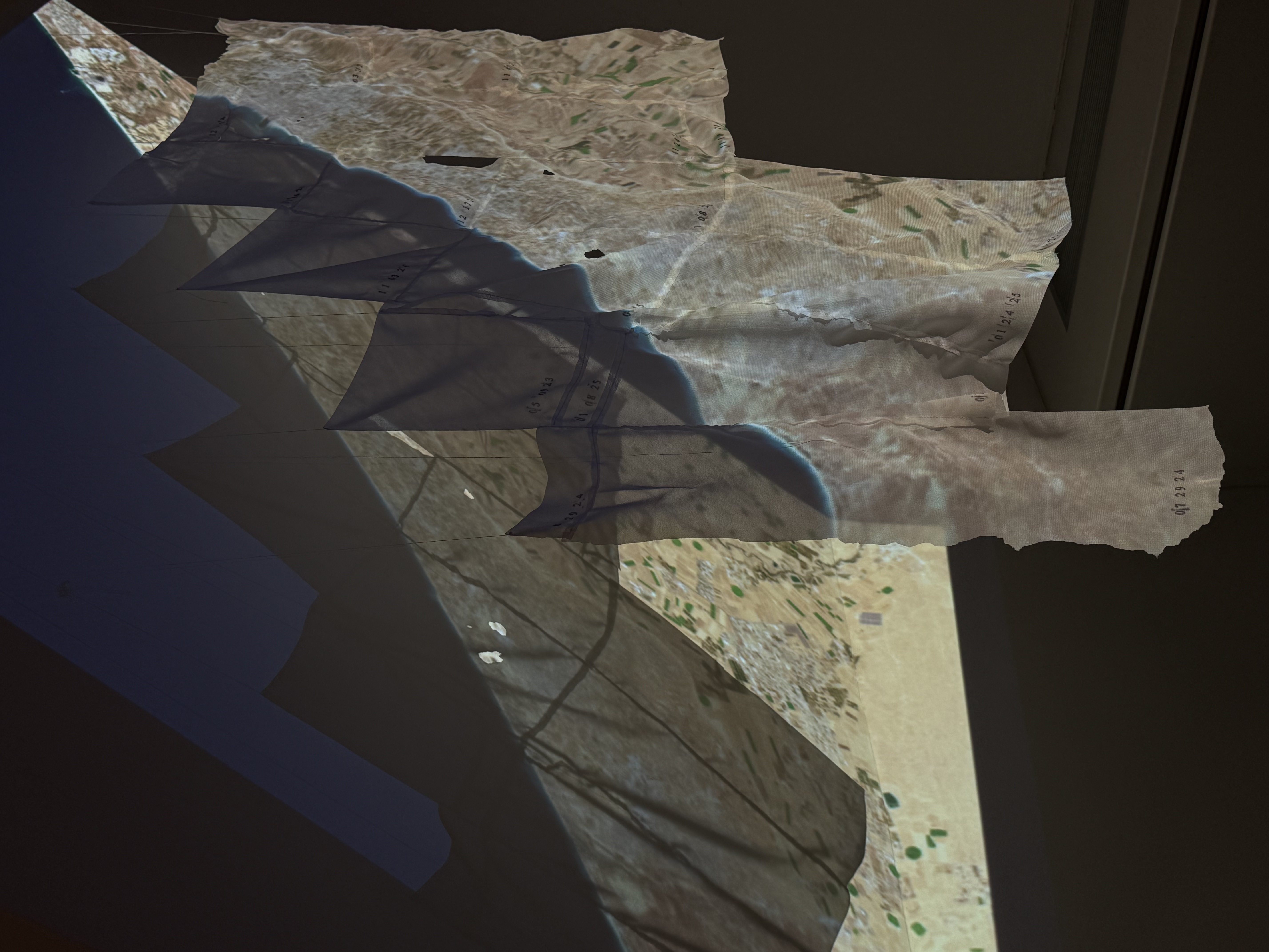
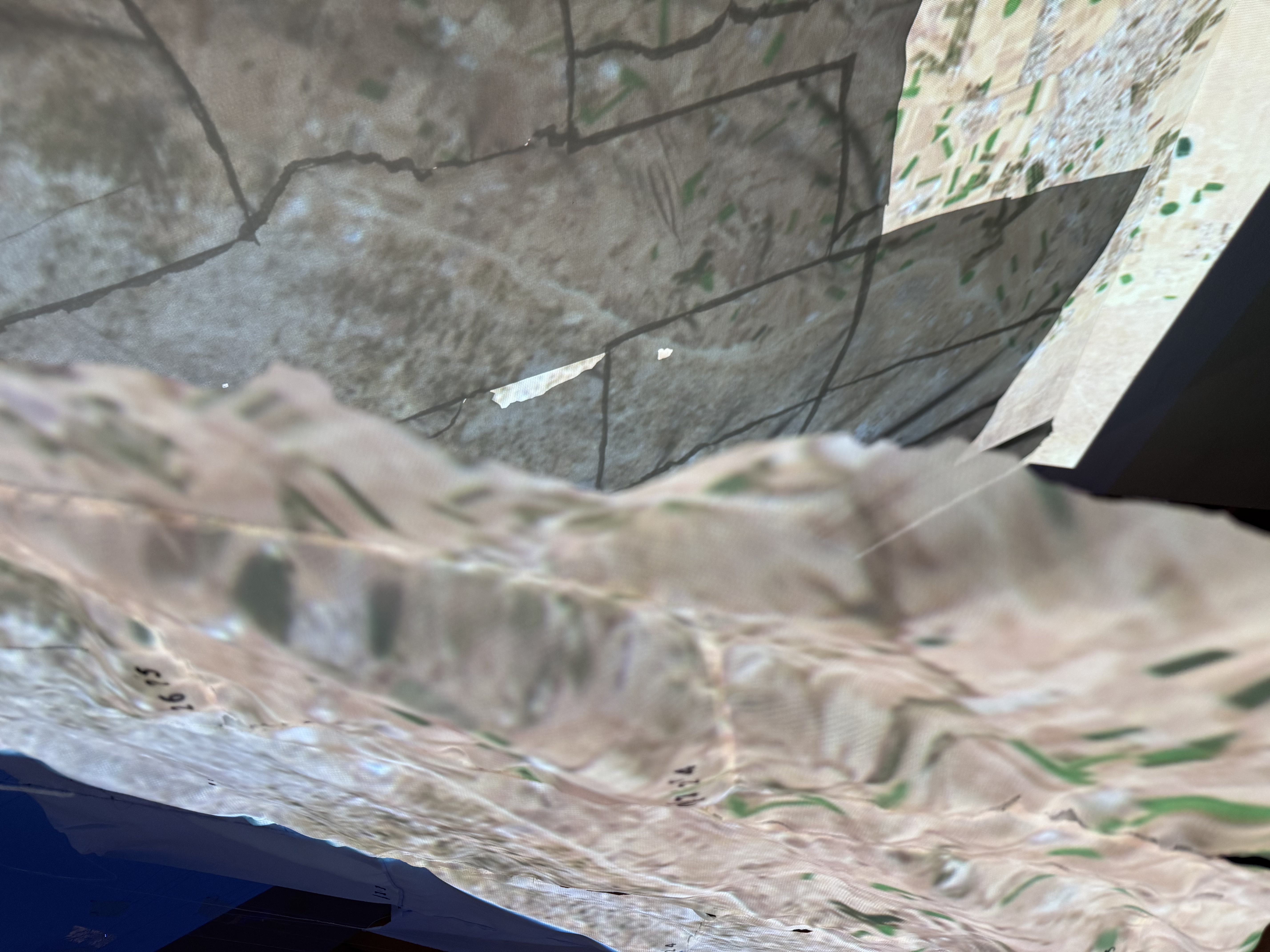
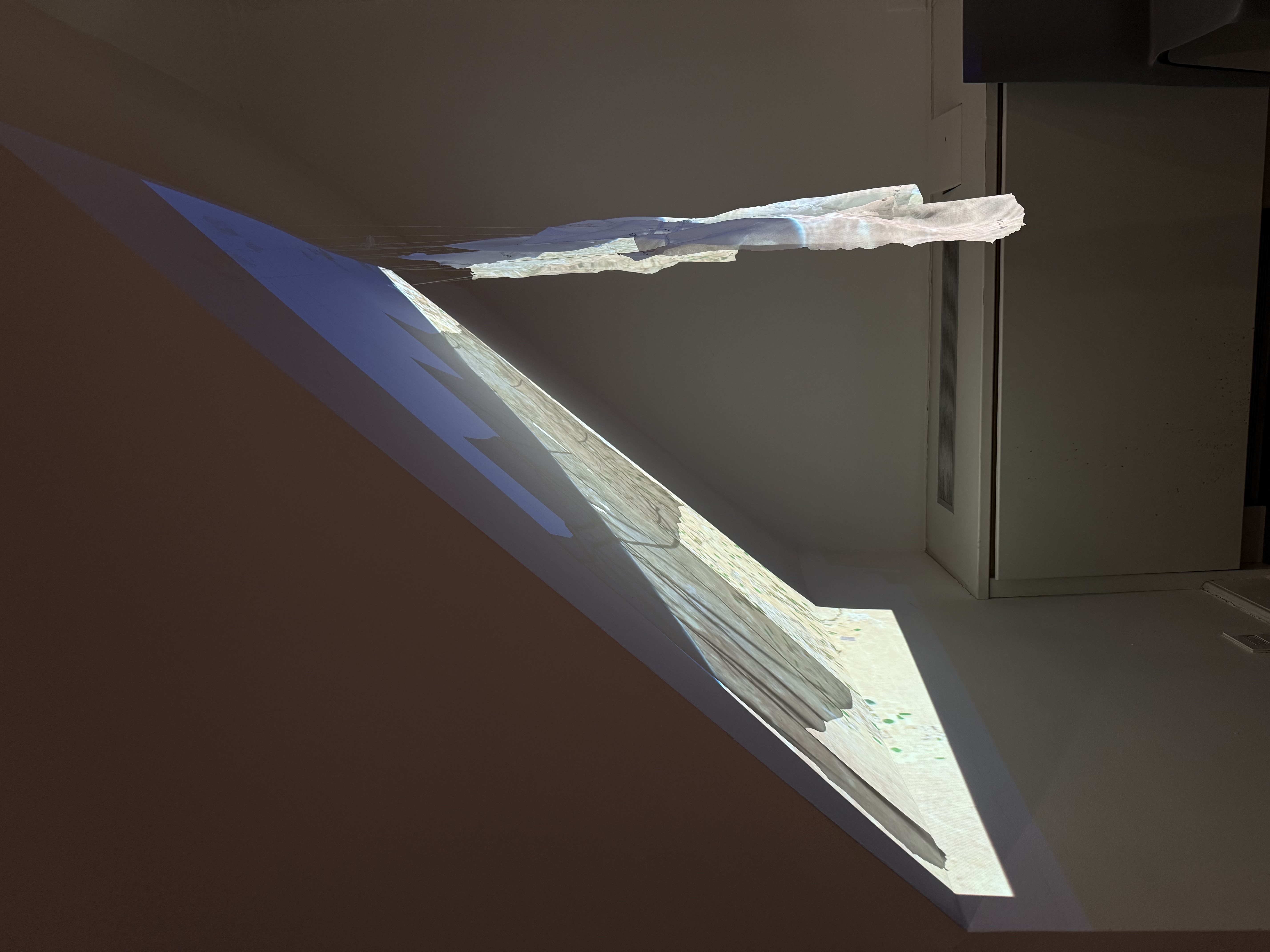
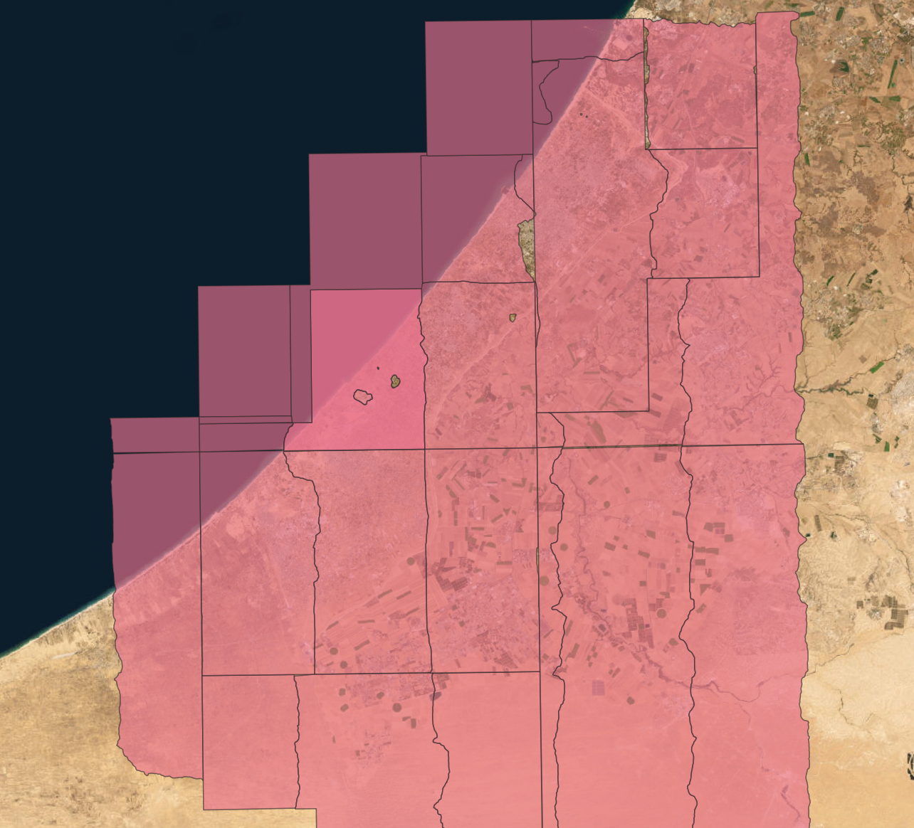
This piece visualizes satellite composites and metadata stitched together in the ArcGIS basemap of the Gaza area. This basemap, made up of imagery from Vantor, is some of the highest resolution free imagery available. However, it is composited of tiles and scales from widely different dates, made noticeable in this context by Israel’s intensive demolition and razing of land over the past three years of genocide. This project seeks to visualize these disparate tiles and temporalities by physically stitching them together, emphasizing the fabrication and human construction of satellite imagery and its role in mediating what we know and how we know it.
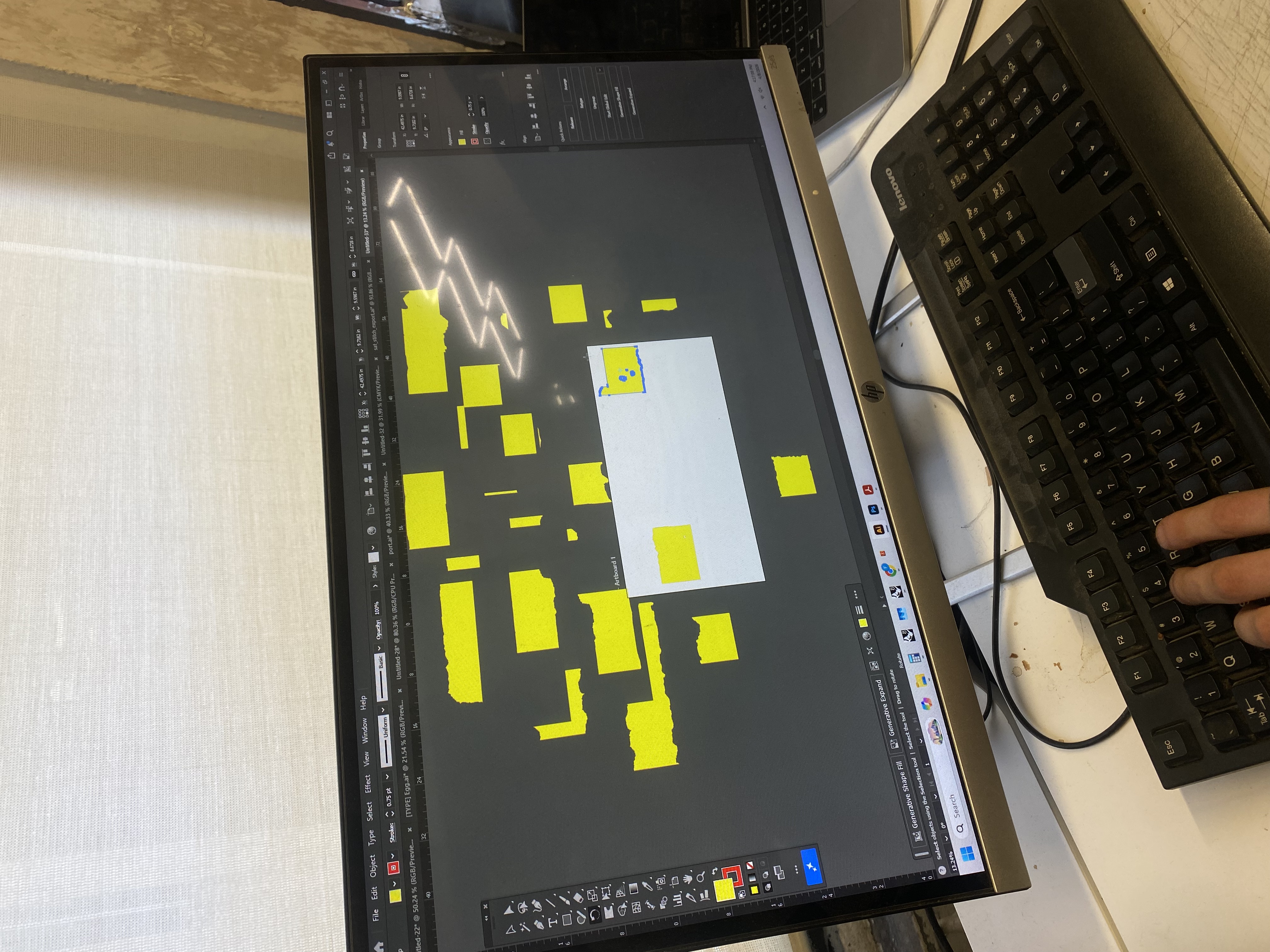
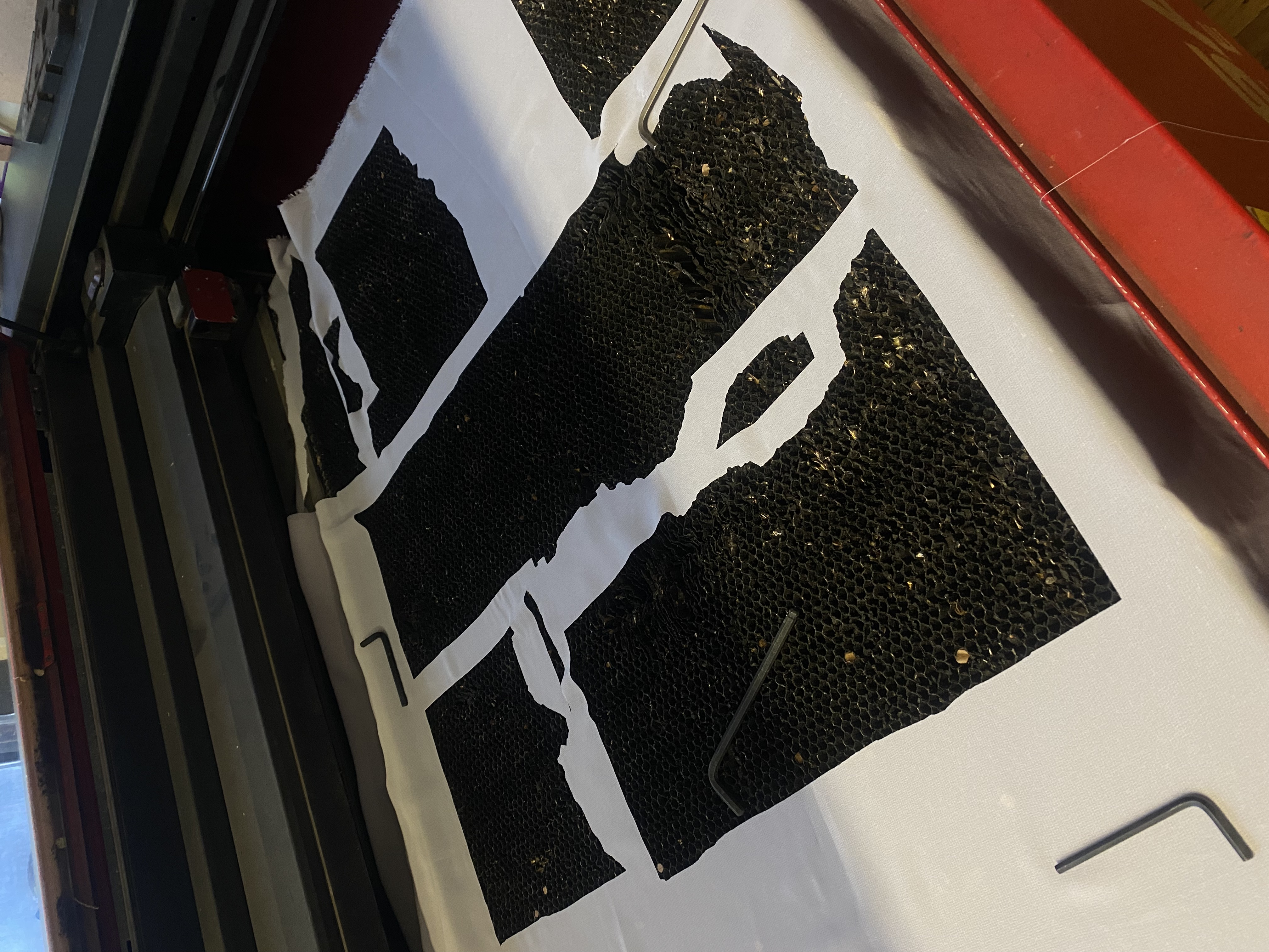
The fabrication of this installation involved scraping satellite footprint shapefiles and metadata from ArcGIS and exporting the footprint files as an SVG file. I then laser cut these shapes into a light, synthetic fabric before sewing them back together and stamping the date of each tile in black ink.