An Atlas of Gaza in Sand
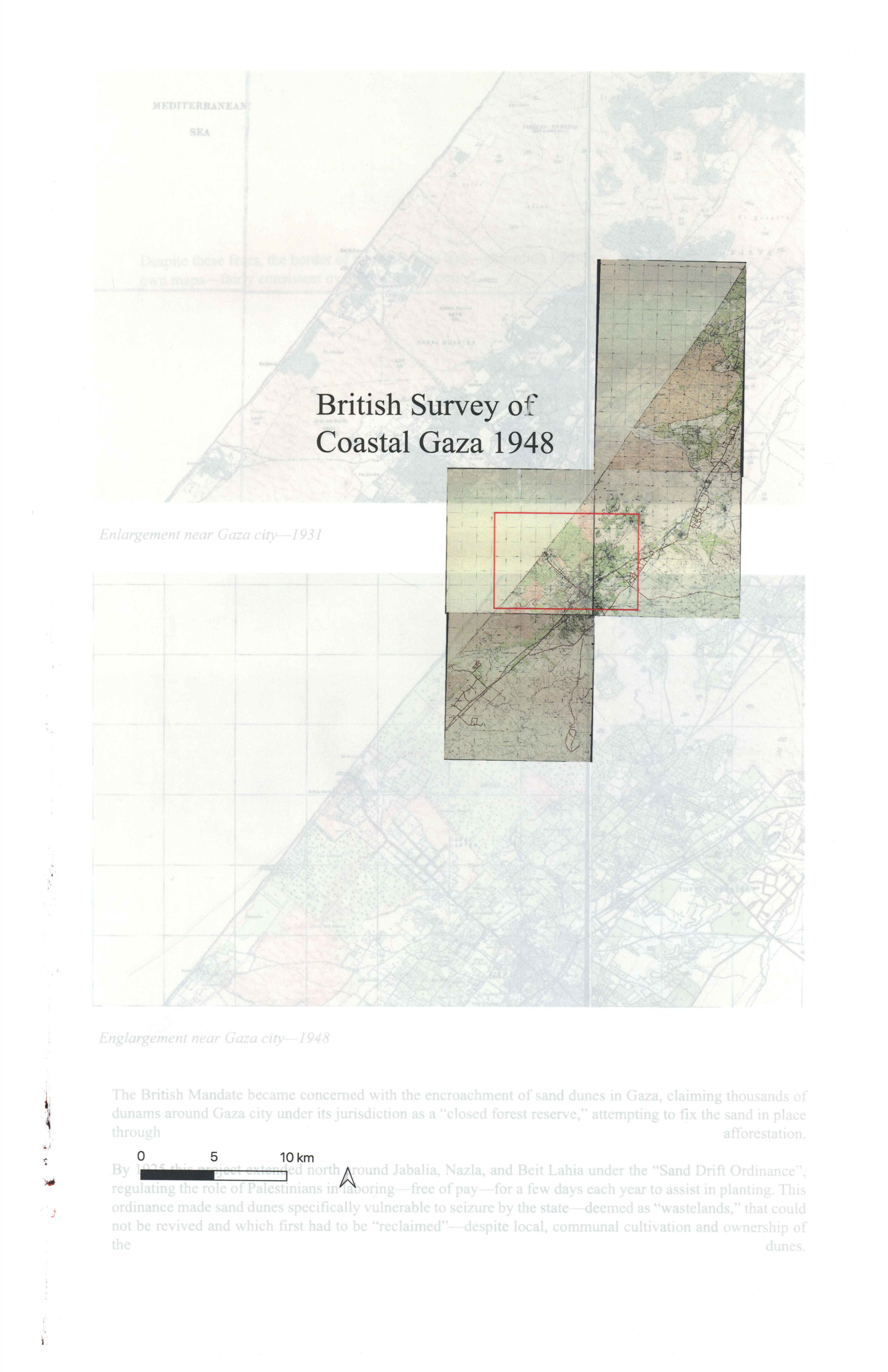
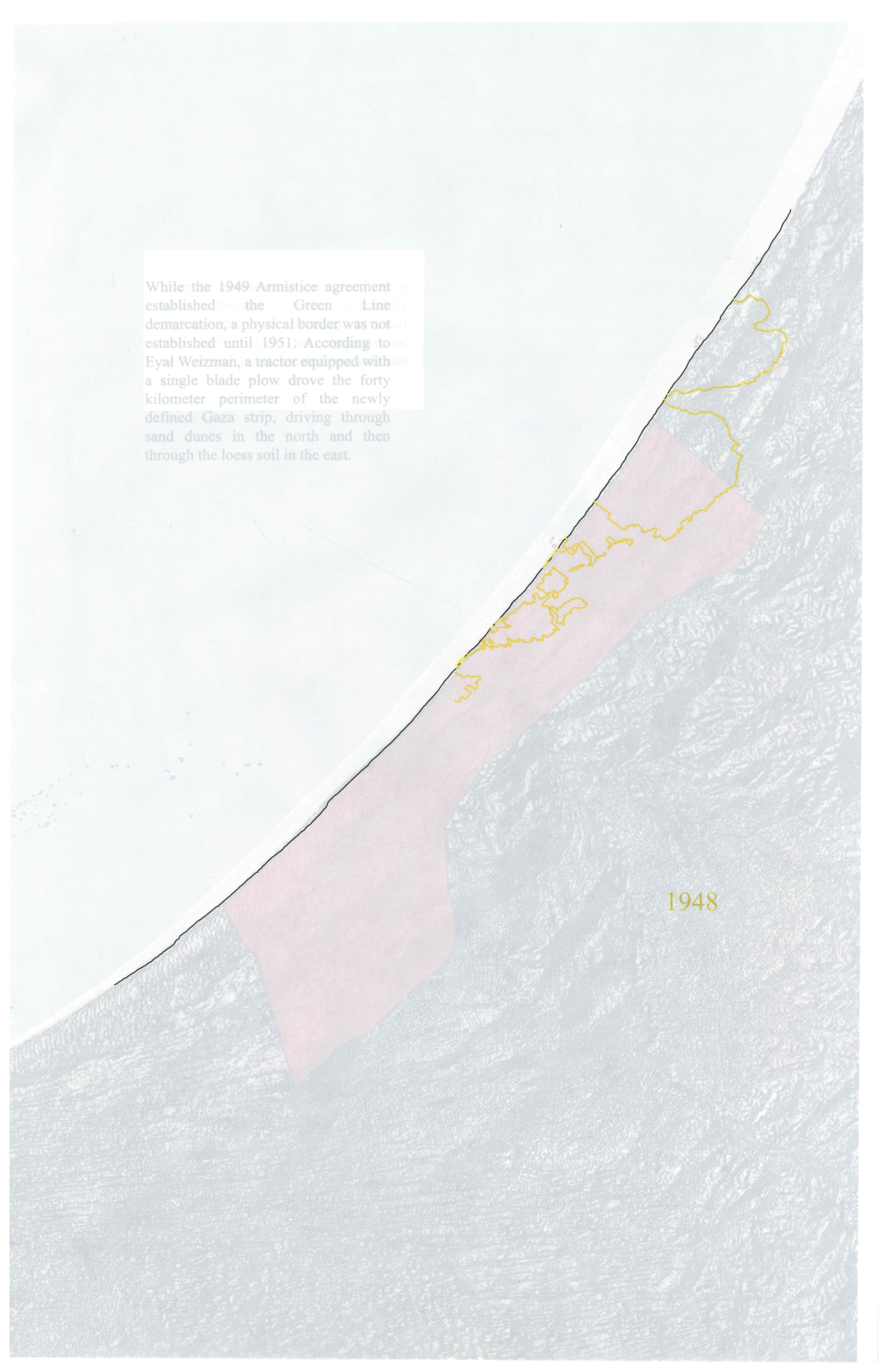
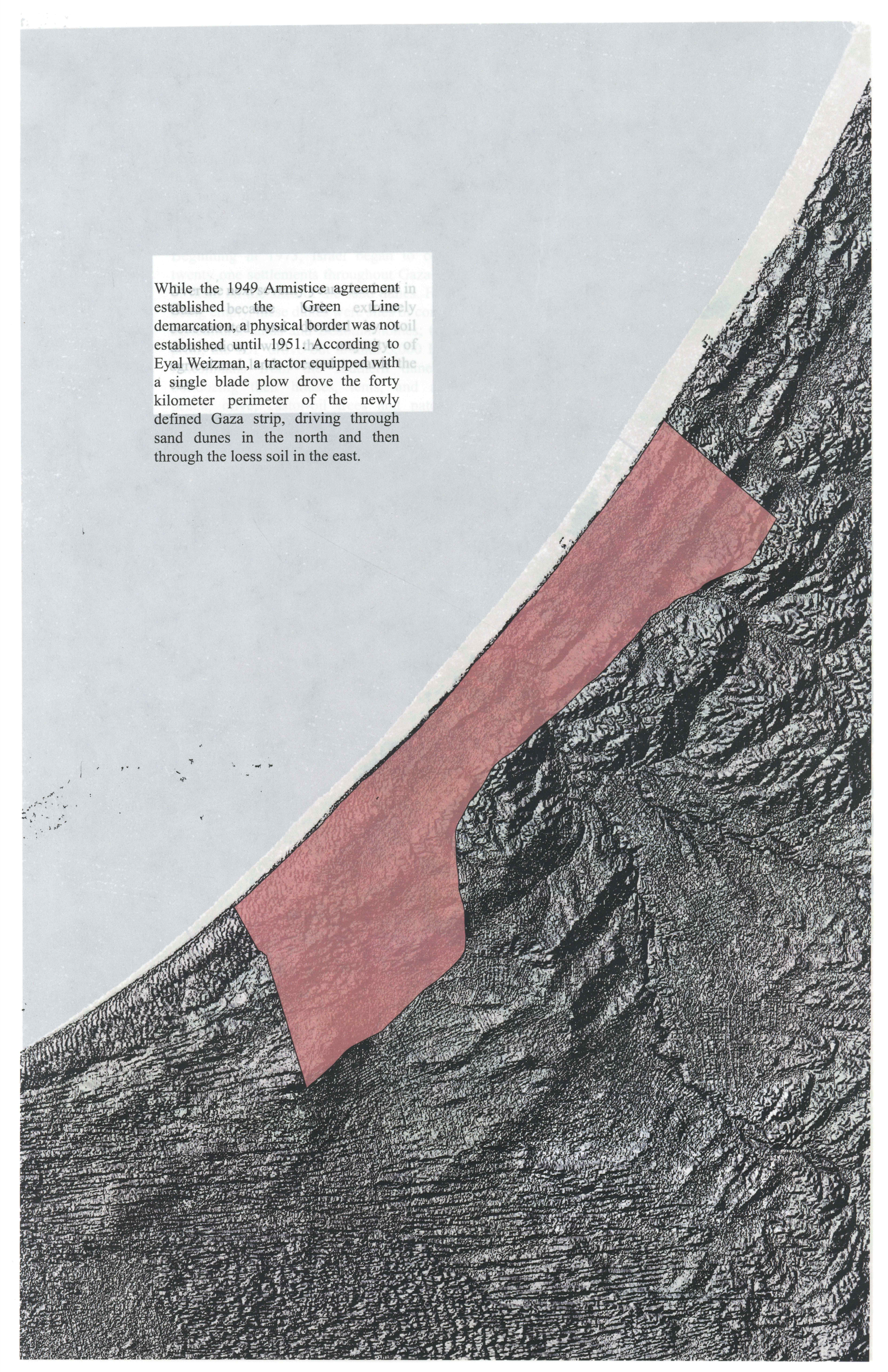
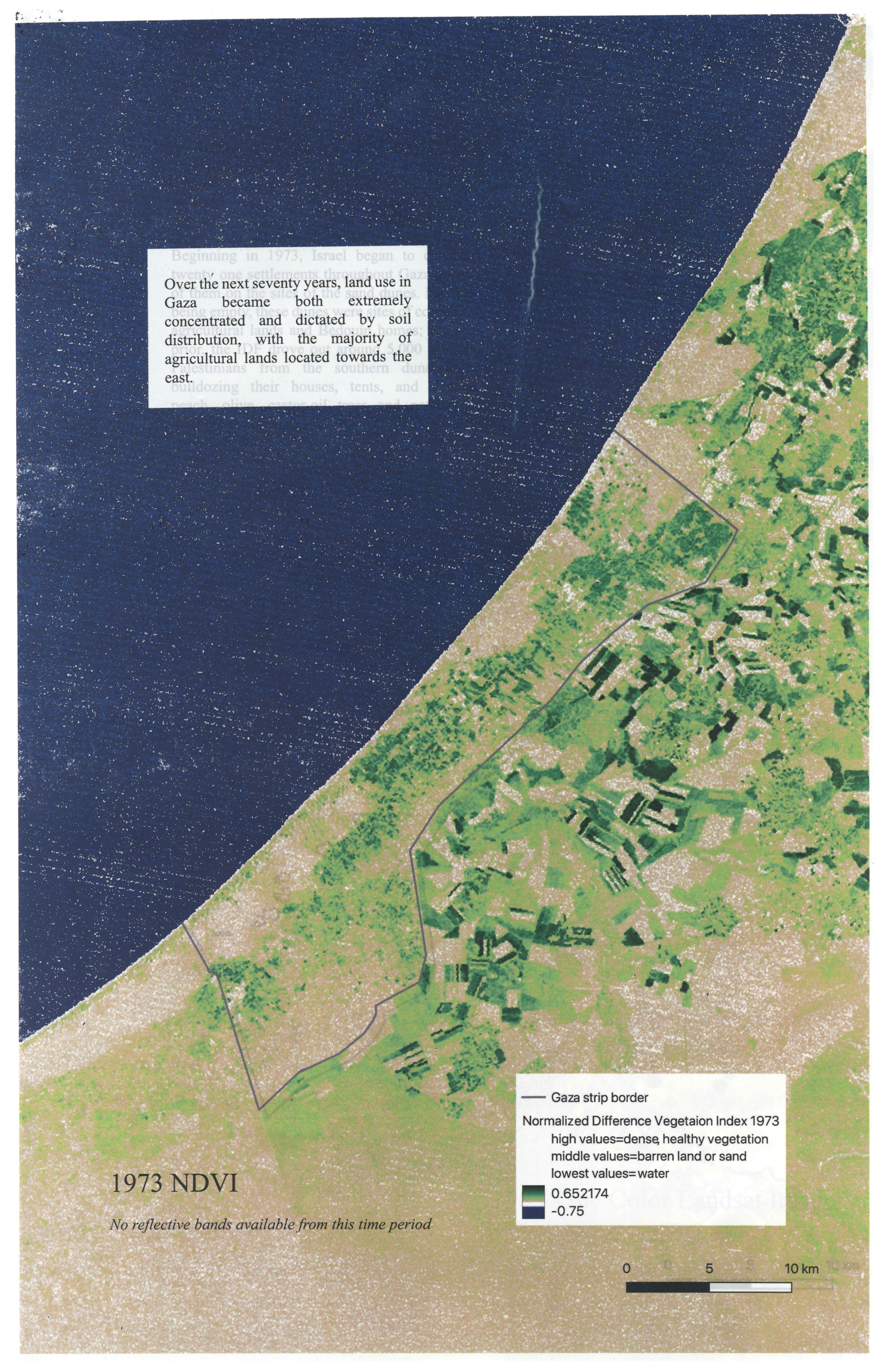
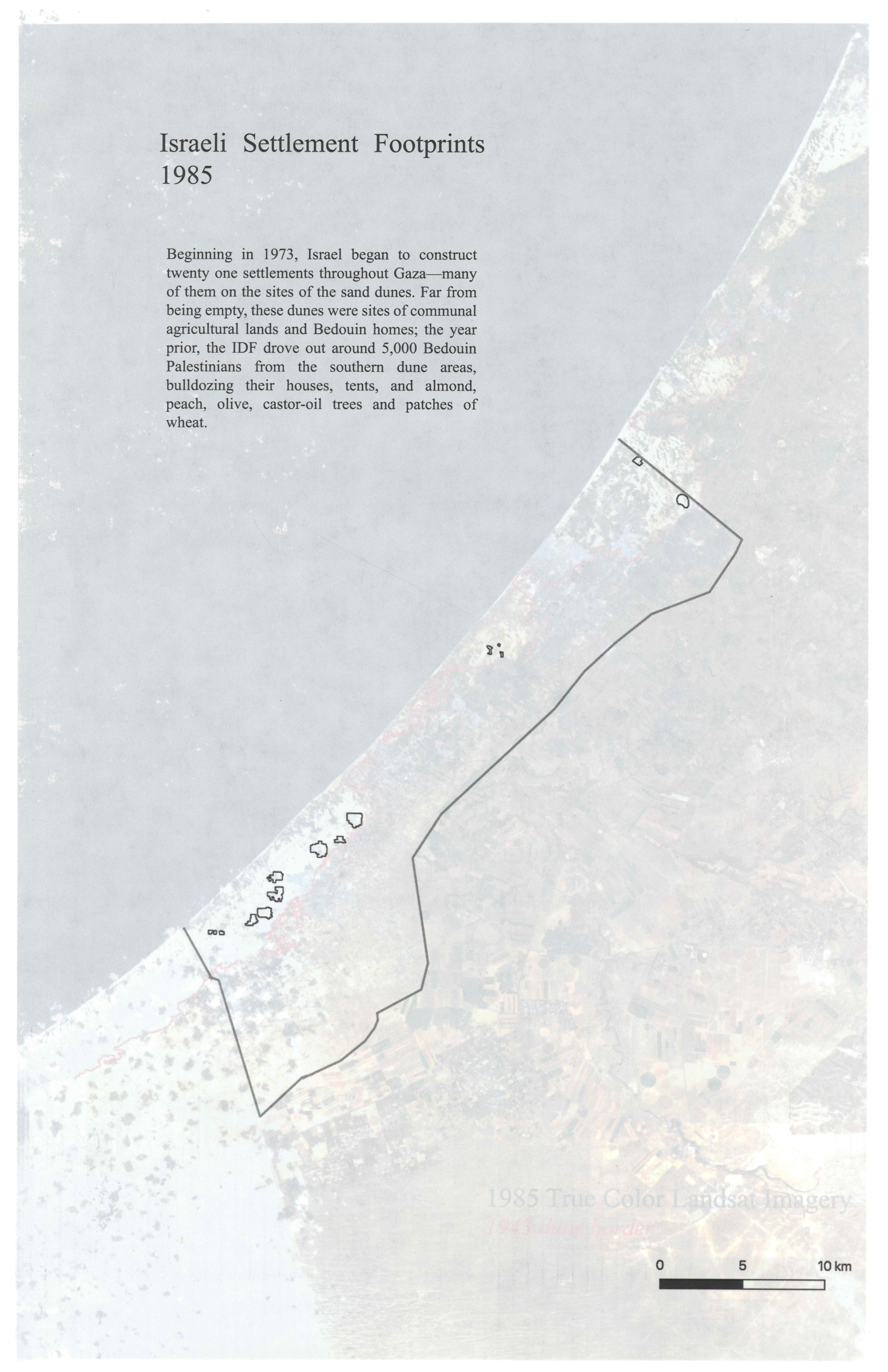
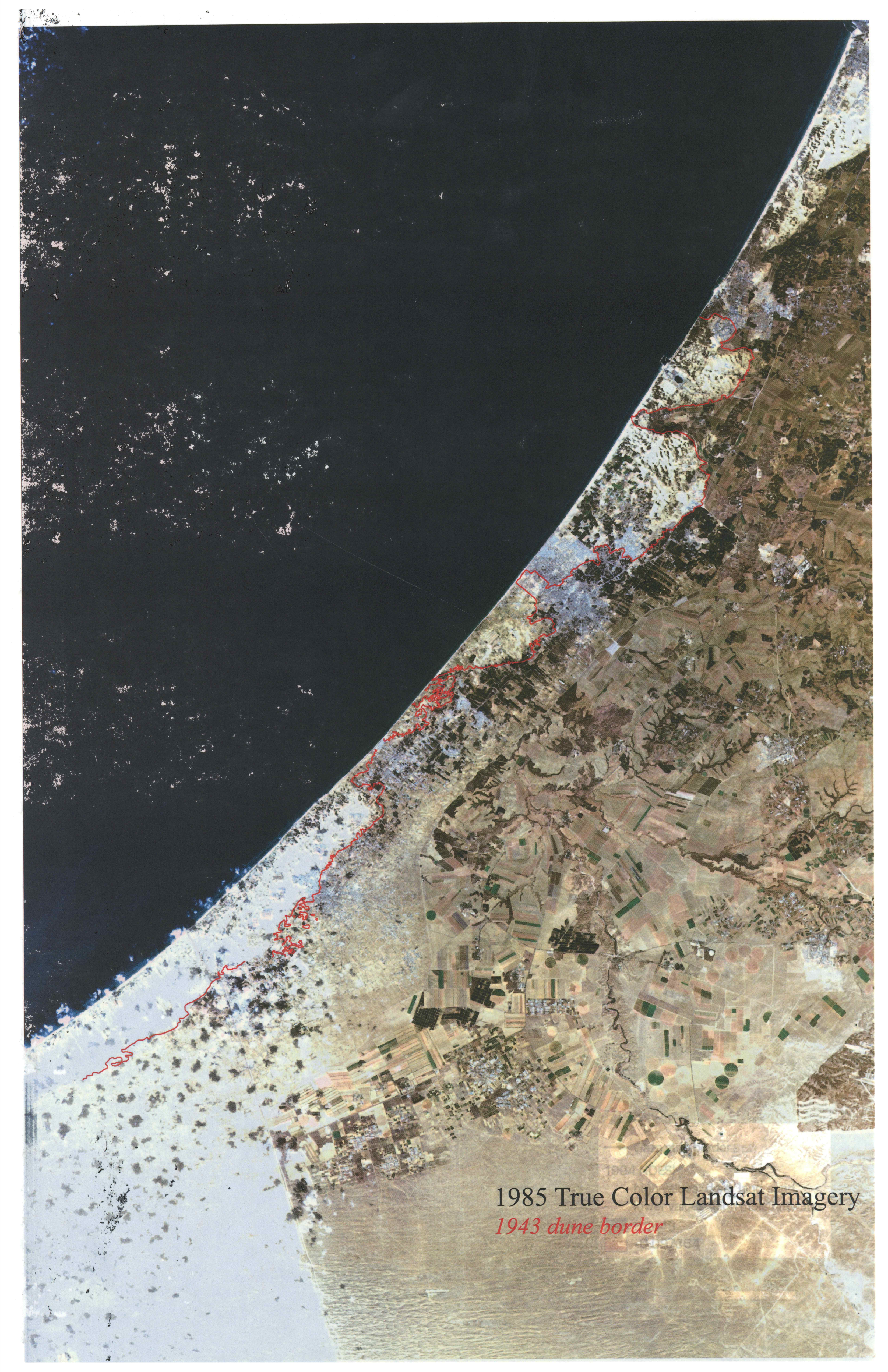
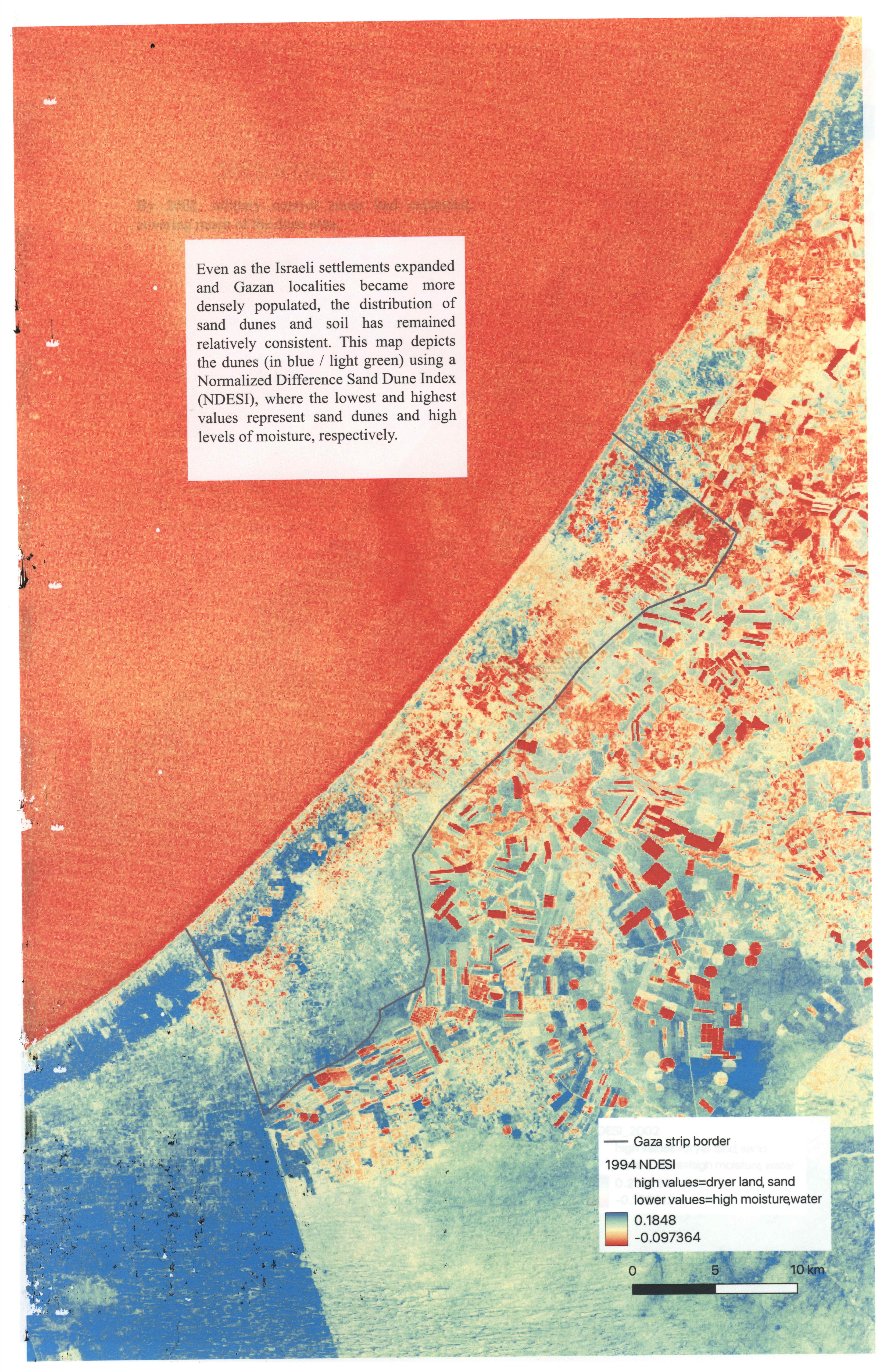
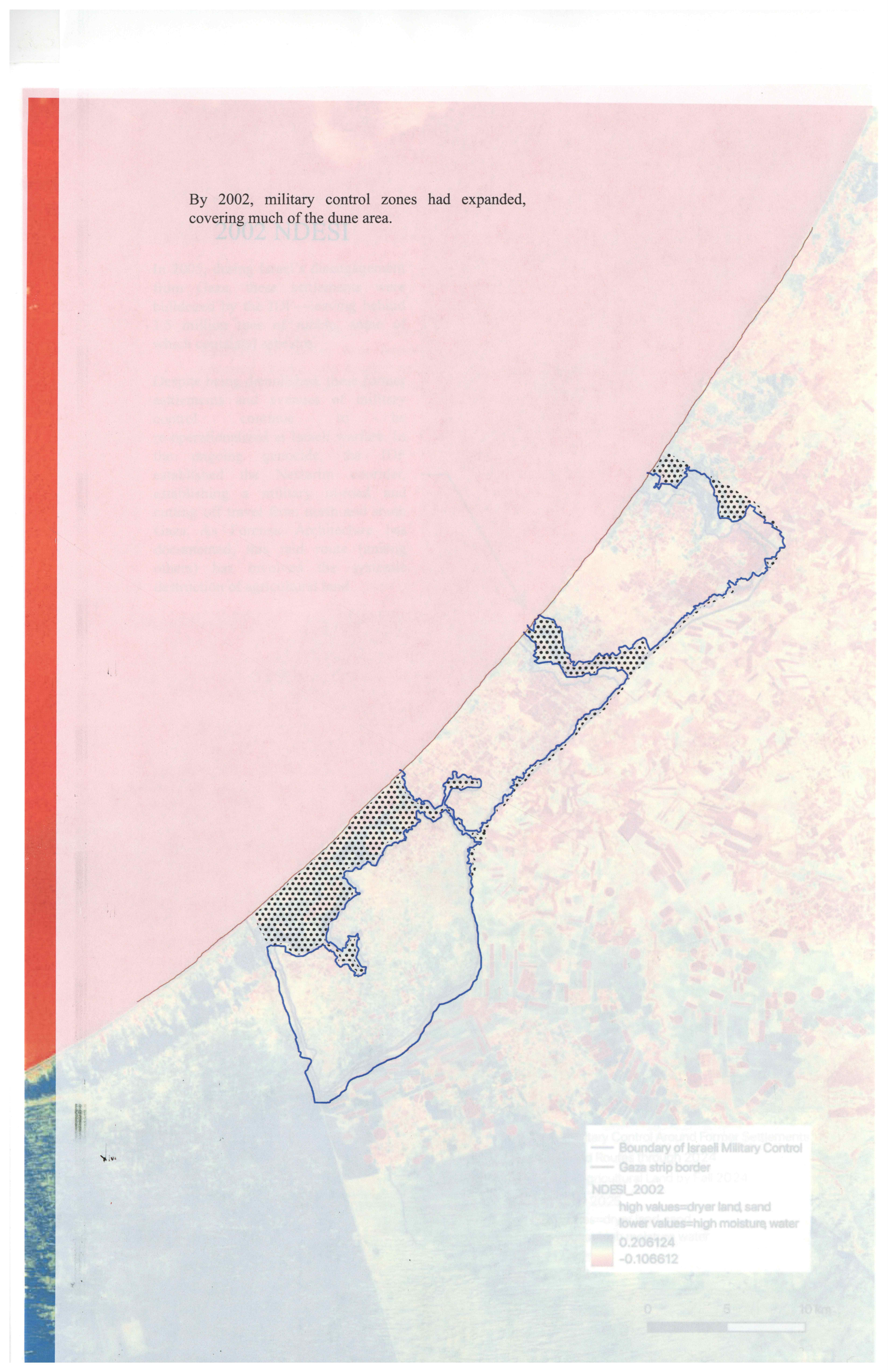
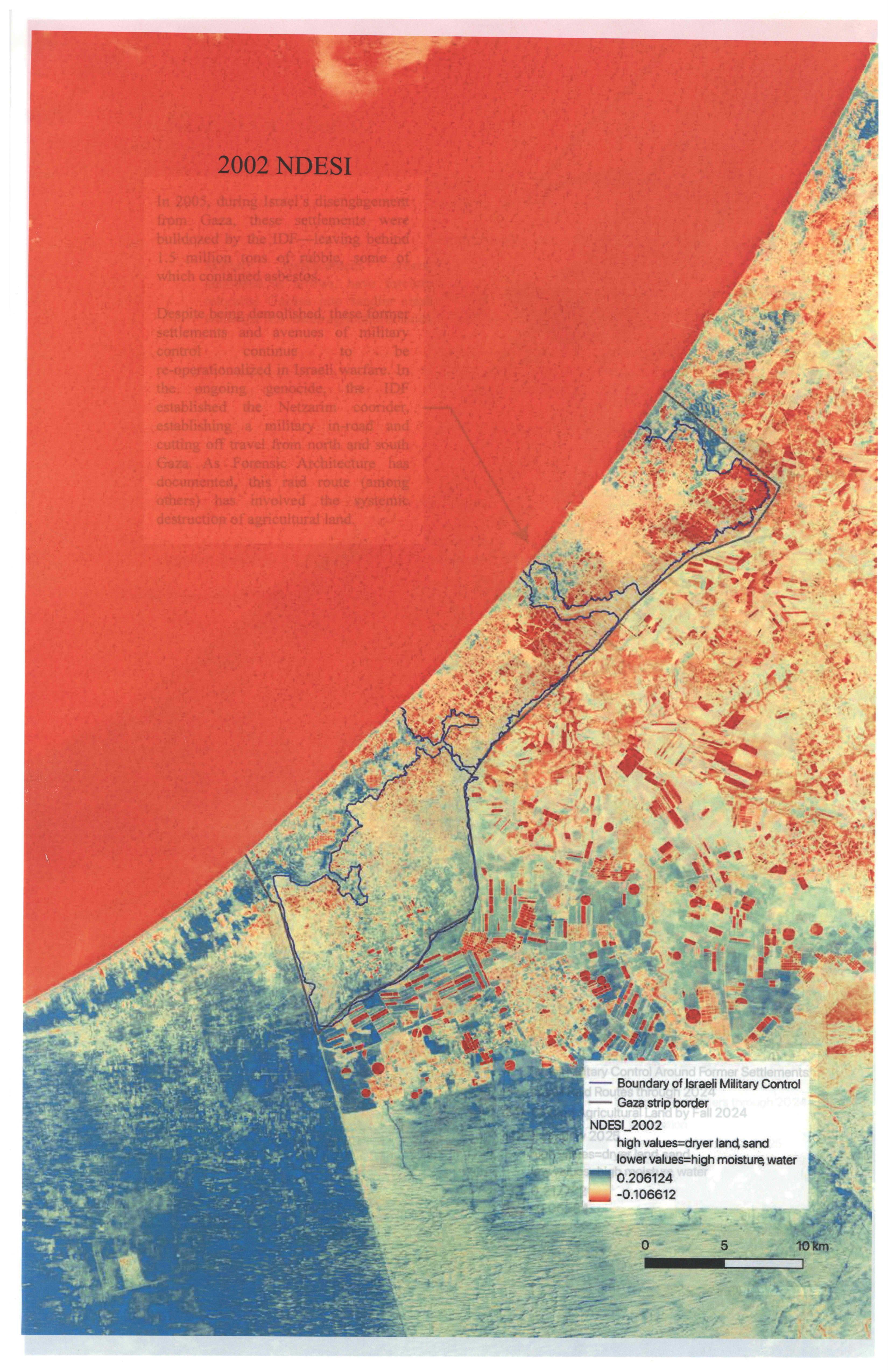
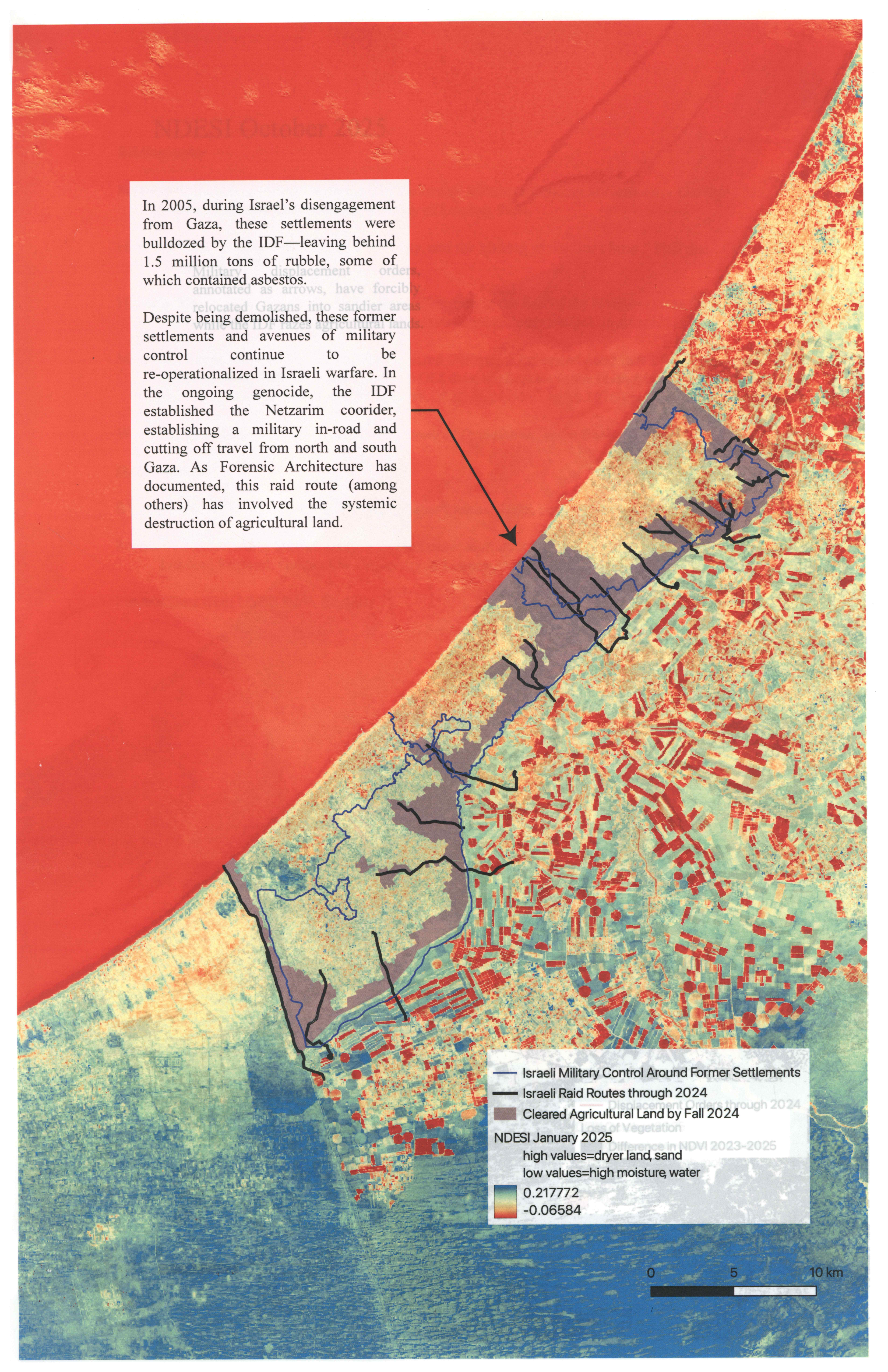
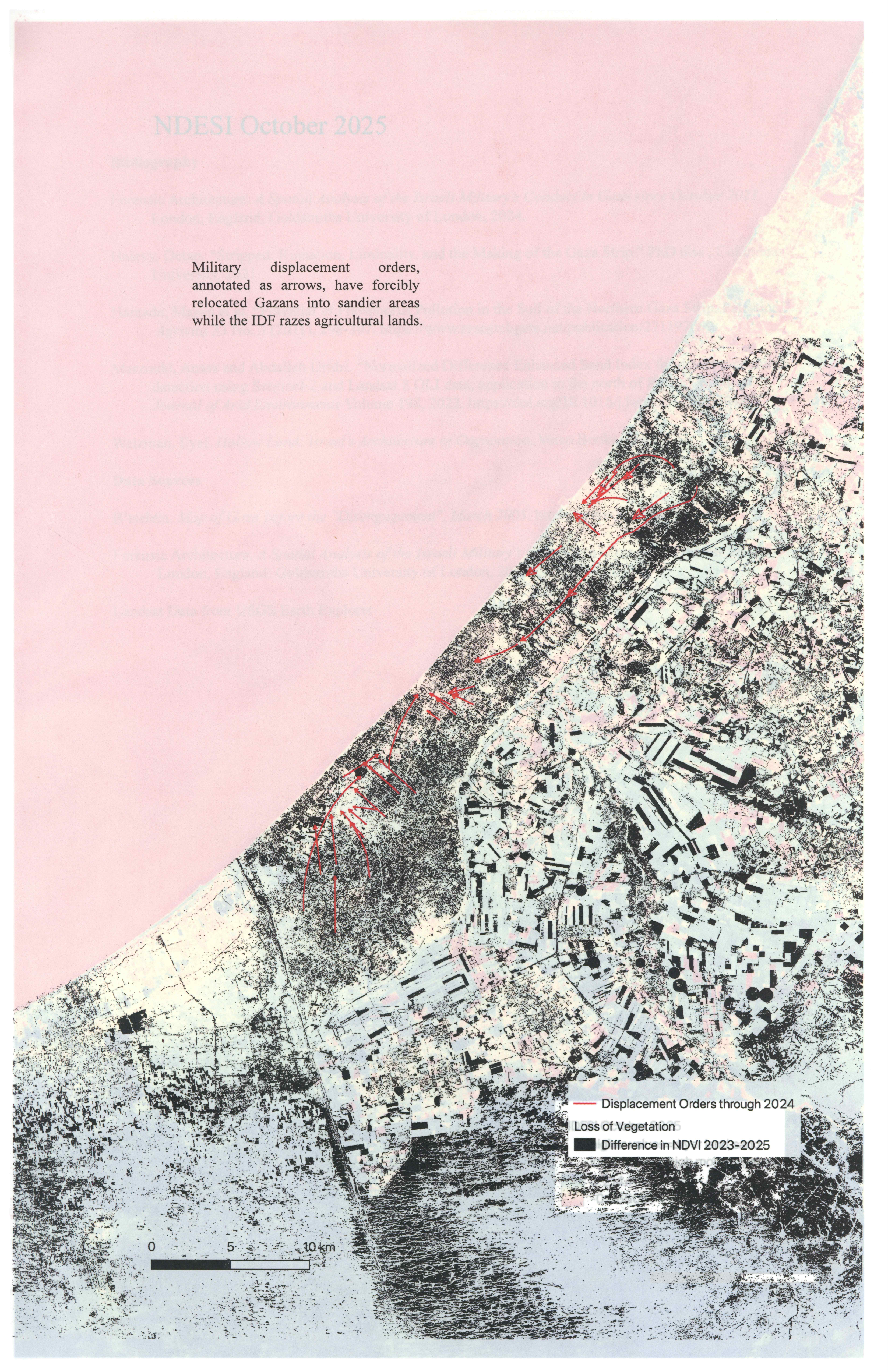
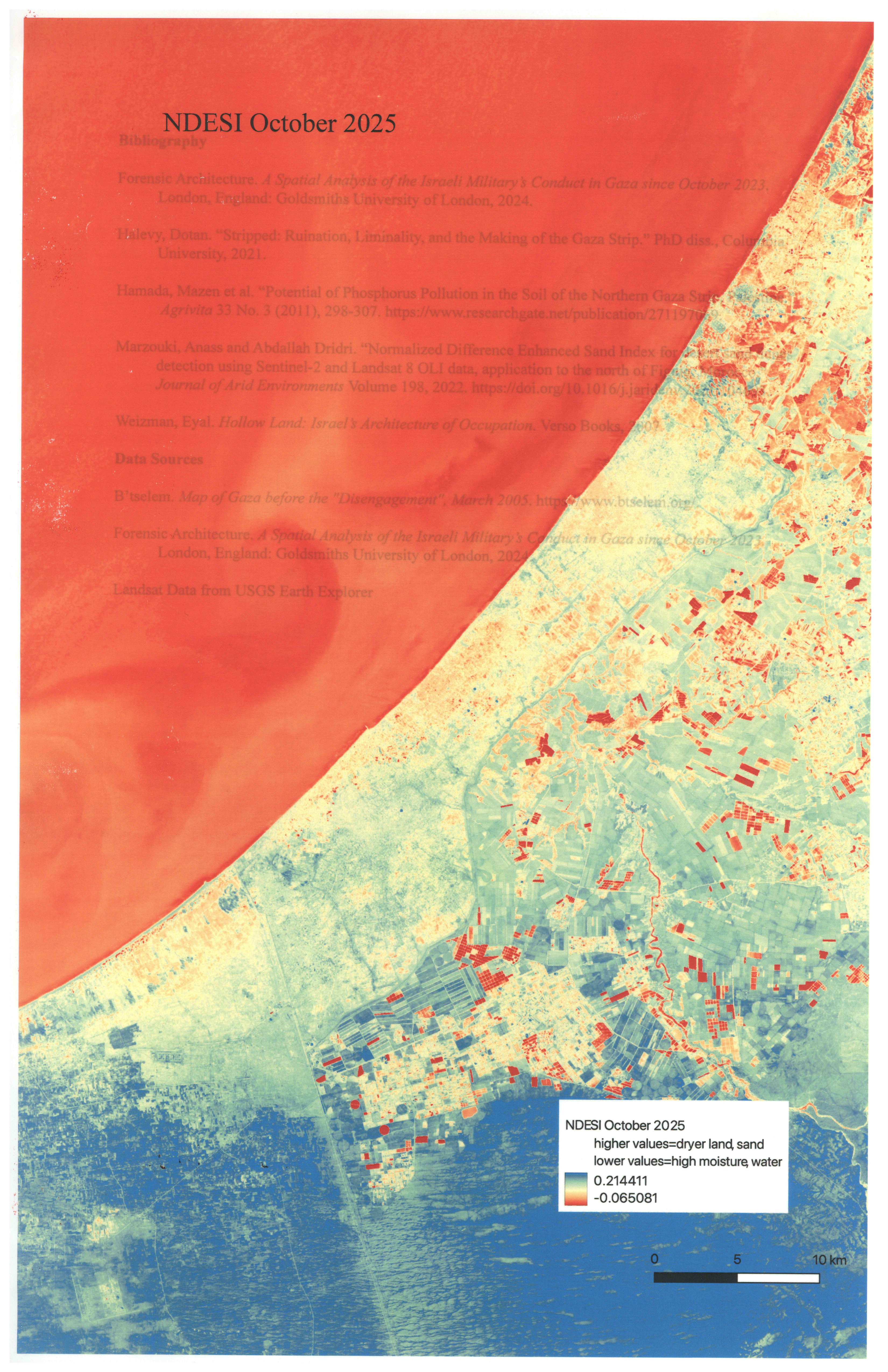
Drawing on maps made by the British Mandate and Israel, Landsat imagery, and data published in Forensic Archicture’s “Cartography of Genocide,” this atlas visualizes processes of state afforestation and settlement over sand dunes in Gaza.
Methods include georeferencing, tracing, NDVI, and calculating Normalized Difference Enhanced Sand Index. This project became a critical foundation for my video work, where I screen recorded myself navigating and interacting with these georeferenced maps and satellite images in QGIS.